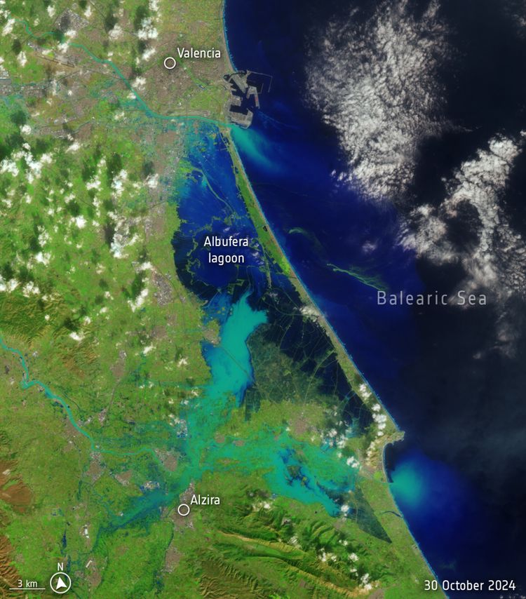
Valencia flood disaster

Spain is suffering its worst flood in decades after torrential rains struck the eastern province of Valencia. The death toll is climbing and people remain missing.
In response, the Copernicus Emergency Rapid Mapping Service has been activated to provide satellite imagery that can support rescue and recovery efforts.
According to Spain’s national weather agency, Aemet, on 29 October 2024, Valencia received a year’s worth of rain in just eight hours. This deluge caused devastating flash floods, turning streets into rivers, destroying homes, and sweeping away vehicles.
These images from the US Landsat-8 satellite vividly illustrate the scale of the disaster, with images from 8 October and 30 October showing the dramatic transformation of the landscape.
Download the side-by-side image.


