Perth gets spectacular light show ahead of Saturday scorcher
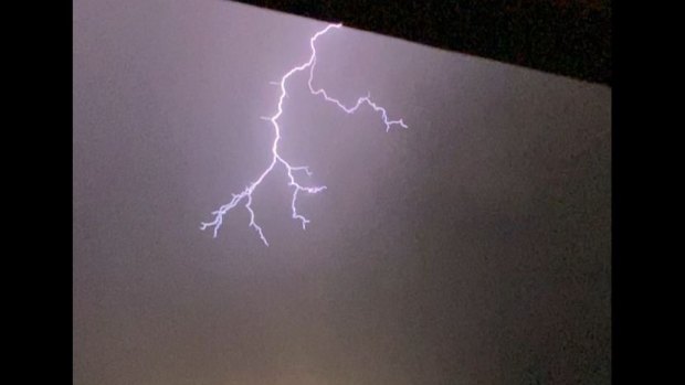
Lighting during the storm on January 12.Credit: Maddison Dutry
Mother Nature treated Perth to a spectacular light show on Friday night ahead of its first predicted day above 40 degrees since February 2022.

The Bureau of Meteorology said about 5000 lightning strikes hit the city as the storm moved south over the city.
The storm was caused by a surface trough that formed north of the city in the afternoon with lots of heat and moisture and was pushed south.
Bureau duty forecaster Luke Huntington said the storm formed near Lancelin and slowly worked its way down the coast, fortunately without any damaging winds that were predicted.
He said the highest rainfall was recorded at Swanbourne with 11 millimetres while Perth recorded 1.8 millimetres – breaking a 44-day dry spell.
Huntington said while they aren’t that common, summer storms like Friday nights were not unusual events.
The storm caused power outages affecting about 6000 homes across the metro area.
The extreme weather continues Saturday with Perth expected to swelter through its first 40-degree day since February 2022.
The Bureau expect the mercury to hit 41 on Saturday afternoon prompting warnings to plan ahead and avoid heat-related health issues.
“Severe heatwaves can be dangerous for many people, especially older people, babies, children, pregnant and breastfeeding women, people with medical conditions and people who are unwell,” the bureau warned.
“Seek a place to keep cool, such as your home, a library, community centre or shopping centre. Close your windows and draw blinds, curtains or awnings early in the day to keep the heat out of your home.”
Thousands of lightning strikes hit Perth overnight.Credit: J Hart
Spare a thought for the aptly named Perth Scorchers and Brisbane Heat players today as they kick off their BBL match at Optus Stadium, AKA the even more aptly nicknamed The Furnace, just after 1pm today.
The heatwave warning covers much of the state for the next three days.
In Perth, temperatures are expected to hover around the mid-30s until Thursday.
Loading
Western Power asset management executive manager Archana Viswanathan said extensive summer preparedness and bushfire mitigation work had been done to prepare the network for summer, but extra precautions are taken during prolonged days of high temperatures.
“While the network is built to withstand very hot temperatures, sustained extreme temperatures and fire weather conditions can impact network infrastructure and our ability to restore power,” he said.
“During these periods we adjust our network settings to reduce fire related risks, which may increase the frequency and duration of potential power outages.
“We ask people to be patient if they are experiencing an outage during the challenging conditions ahead. This includes the metro area as fire weather conditions can impact restoration times if an asset traverses a heavily vegetated area like a park.”
Loading


