Unstable weather hits WA, with more on the horizon next week
Rain, thunderstorms and a wintry airmass are impacting WA this Friday, with signs that a low pressure system could generate severe weather next week.
A low pressure system in the Bight is extending a cold front across southern WA on Friday morning with another low pressure trough in the Kimberley bringing rain and thunderstorms to northern WA.
The map below shows thunderstorms and showers impacting southern WA on Friday morning as the sun rises.
Image: Himawari-9 satellite image, radar and lightning at 6:50 am on Friday, September 27.
Parts of WA have already seen 50 to 150mm this week as rain and thunderstorms lashed the state in response to a northwest cloudband. The Pilbara region saw its heaviest September rain in half a century in the 24 hours leading up to 9am Sunday, September 22.
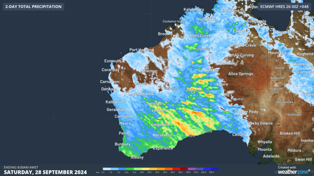
Yet more rain is set to fall across parts of WA in the next 48 hours as a cold front and low pressure trough impact the state on Friday. Widespread falls of 15 to 30mm are forecast across a wide area of the state, including Perth, meanwhile isolated falls of 40 to 50mm could fall in thunderstorms.
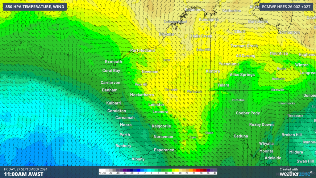
Image: Accumulated rain for the two days leading up to 8am on Saturday, September 28 according to ECMWF
In addition to the rain and thunderstorms, a cold airmass is on its way to southwest WA, which will cause temperatures to drop behind a blustery southerly change.
Image: 850 hPa temperature and wind at 11am AWST on Friday, September 27 according to ECMWF.
The southerly change is moving over the Perth region this morning, with daytime temperatures expected to peak at 17 to 19°C on both Friday and Saturday.
The strong southerly winds will make the temperature feel around 9 to 10°C in Perth late Friday afternoon into the evening.
The night-time temperatures will also be chilly with minimums of 8 to 10°C forecast over the weekend into early next week. Temperatures will begin to warm up on Sunday into Monday as skies clear under the influence of a high pressure ridge moves into the fronts wake.
WA will see a brief respite, with sunny conditions and temperatures reaching the high 20s to low 30s by mid next week ahead of significant low.
Early computer modelling suggests a cut-off low pressure system will approach the west coast mid to late next week, which has the potential to generate severe thunderstorms and more rain for parts of the state. Please keep an eye out for the latest forecasts and warnings for next week as this system unfolds.


